Not all of Sarasota floods equally. Understanding your flood zone determines your insurance requirements, your risk during hurricane season, and how you should prepare your home. Here’s a practical breakdown of flood risk across the Sarasota area.
Understanding FEMA Flood Zones
FEMA designates flood zones with letter codes. The ones relevant to Sarasota:
- Zone A / AE: High-risk flood area. 1% annual chance of flooding (the “100-year floodplain”). Flood insurance is REQUIRED if you have a federally backed mortgage.
- Zone VE: High-risk coastal area. Same flood probability as AE, but with additional wave action hazard. Stricter building requirements. Most of Sarasota’s barrier islands fall here.
- Zone X (shaded): Moderate risk. 0.2% annual chance (500-year floodplain). Flood insurance not required but recommended.
- Zone X (unshaded): Minimal risk. Flood insurance not required but still available.
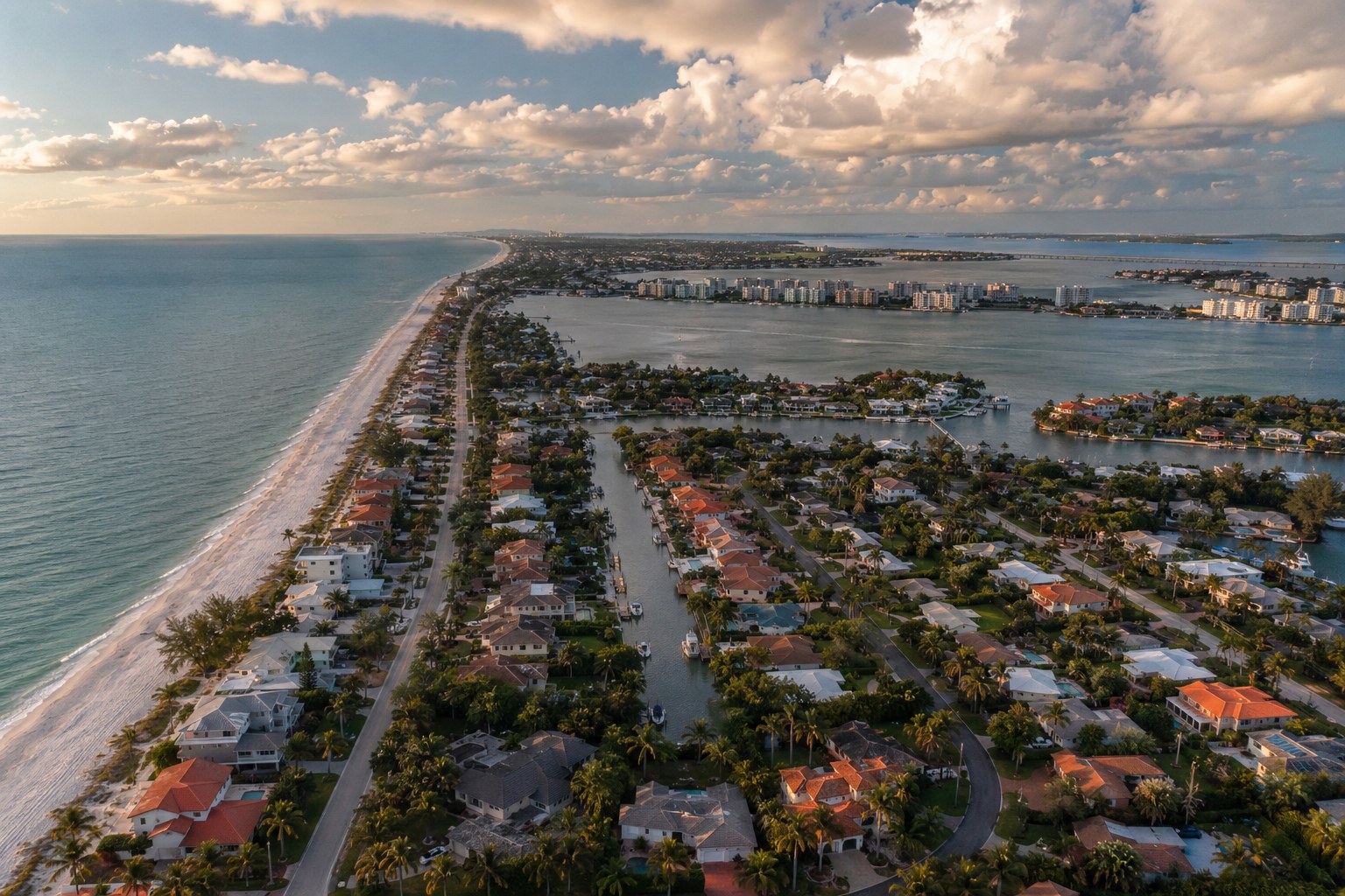
Highest-Risk Areas in Sarasota County
Barrier Islands (Zone VE — Extreme Risk)
Siesta Key — The entire island is in a high-risk flood zone. The north end near Siesta Village and the south end at Turtle Beach are particularly vulnerable to storm surge. Hurricane Ian (2022) pushed 4-6 feet of storm surge across parts of the island.
Longboat Key — Narrow barrier island with Gulf exposure on one side and Sarasota Bay on the other. Storm surge can come from either direction. Many luxury properties sit in VE zones with the highest flood insurance premiums in the county.
Lido Key / St. Armands — Low elevation with limited escape routes. St. Armands Circle businesses flood regularly during tropical storms. Lido Beach road can become impassable with even moderate storm surge.
Coastal Mainland (Zone AE — High Risk)
Indian Beach / Sapphire Shores — Bayfront neighborhood with aging seawalls. Properties along the bay are in AE zones. King tides cause nuisance flooding multiple times per year.
Osprey / Casey Key — Little Sarasota Bay properties in The Oaks and Sorrento Shores face bay-side surge. Casey Key is another vulnerable barrier island.
Downtown Sarasota bayfront — The area along Bayfront Park and Marina Jack floods during strong storms. Climate projections show increasing frequency.
Inland Flood-Prone Areas (Zone AE/X)
Gulf Gate / Southgate — Older neighborhoods with undersized drainage infrastructure. Heavy rain events cause street flooding and sewer backups. Many properties are in or near AE zones along Phillippi Creek.
North Port (Myakkahatchee Creek) — The canal system and creek corridors flood during heavy rain events. Hurricane Ian caused widespread flooding here — many homes that had never flooded before took on water.
Venice (South Venice / Venice Gardens) — Low-lying areas along the Myakka River and Curry Creek. South Venice experienced significant flooding during Hurricane Ian.
Englewood / Manasota Key — Lemon Bay area properties and Manasota Key face surge from both the bay and Gulf sides.
Storm Surge Risk by Category
Sarasota County’s storm surge projections (approximate maximum surge levels):
- Category 1 hurricane: 3-6 feet surge on barrier islands, 1-3 feet coastal mainland
- Category 2 hurricane: 6-10 feet surge on barrier islands, 3-6 feet coastal mainland
- Category 3 hurricane: 10-15 feet surge on barrier islands, 6-10 feet coastal mainland
- Category 4+: 15-20+ feet — catastrophic flooding well inland
Hurricane Ian (2022) made landfall as a Category 4 near Fort Myers, and Sarasota County still saw 4-8 feet of storm surge in many areas despite being north of the eye.
Neighborhoods with Lower Flood Risk
Some Sarasota-area neighborhoods have relatively lower flood risk:
- Lakewood Ranch — Higher elevation, newer construction with modern drainage, mostly Zone X
- Palmer Ranch — Planned community with stormwater management, largely outside high-risk zones
- University Park — Higher ground, away from coastal surge, Zone X
- East Bradenton — Higher elevation areas away from the Manatee River
Important: Lower risk doesn’t mean no risk. Hurricane Ian proved that areas outside flood zones can still flood from unprecedented rainfall.
What This Means for You
- Check your flood zone — Use FEMA’s Flood Map Service Center or Sarasota County’s GIS portal to look up your property
- Get flood insurance even if not required — 25-30% of flood insurance claims come from properties outside high-risk zones
- Know your evacuation zone — Sarasota County uses zones A through E for evacuation orders (different from FEMA flood zones)
- Prepare your home — If you’re in a flood zone, know your shut-off valves, keep important documents elevated, and have a water extraction plan
After the Flood
Whether you’re in Zone VE or Zone X, water damage demands the same fast response. In Sarasota’s humidity, mold growth begins within 48 hours regardless of your flood zone designation. Professional water extraction and drying within the first 24 hours is the most cost-effective protection against secondary damage.
Dealing with water damage in Sarasota?
Describe what happened and a licensed local contractor will call you back — usually within an hour. No cost, no obligation.
Get Your Free Assessment